
Border Conflicts
05 Oct 2016 - 05 Jan 2017
BORDER CONFLICTS
5 October 2016 - 5 January 2017
Produced in association with Le Monde diplomatique (Spanish edition) and Fundación Mondiplo, this exhibition is a survey of some of the most dramatic transformations that certain borders have undergone deep within our continents, driven by dynamics of past centuries which are still present today and auger equally mutable futures.
Maps are never definitive. The boundaries of countries change as a consequence of historical events predetermined by the human race. Rarely has a territory vanished in the wake of a natural disaster. In most cases, the shifting outlines of the states that make up our so-called international community are drawn and redrawn by conflicts, wars, treaties and agreements, not always with the consent or direct involvement of affected citizens.
After centuries dominated by vast empires, colonising adventures, local or world wars, new borders and the emancipation and birth of new states, globalisation—a phenomenon closely linked to the digital revolution—finally seems to have blurred the more or less historical contours and turned the world into a planetary village characterised by the immediacy of commercial and financial flows. This new world, open to the free circulation of goods and services, information, sport and the arts, has dynamited—in theory at least—all national boundaries, whether set in stone or hastily pencilled in. Mobility, fluidity and adaptability are united under the banner of "without borders". Pure wishful thinking.
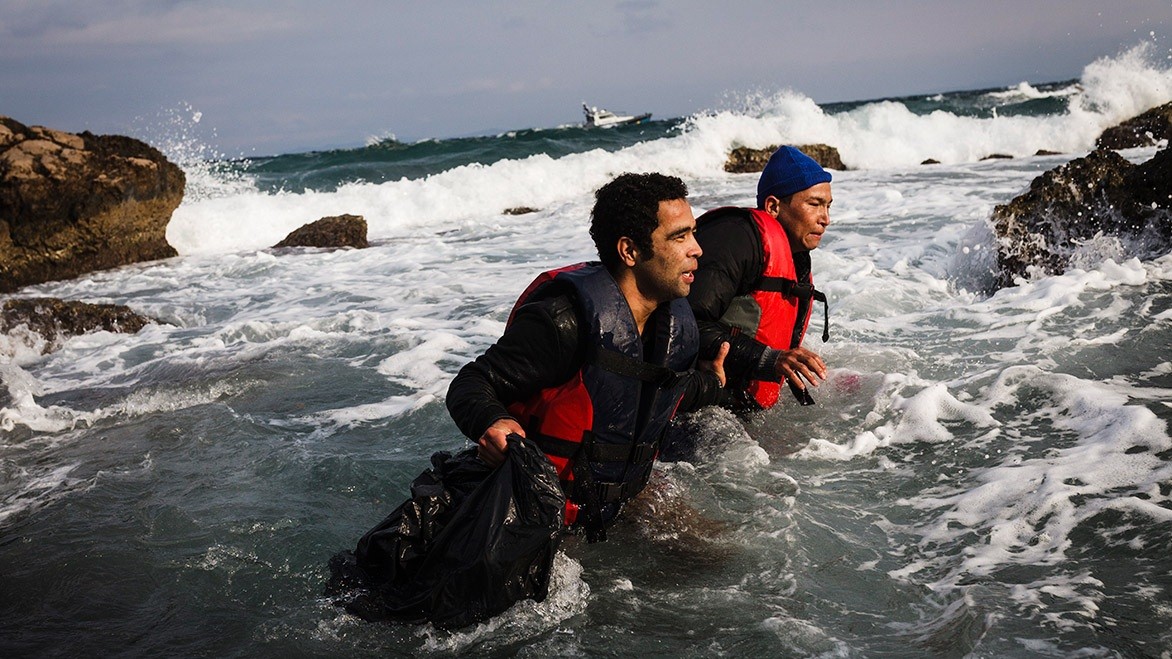
The maps of the 18th and 19th centuries were altered during the 20th century, and in the 21st century they continue to change. Our societies, so interconnected in many ways, nevertheless show signs of physical, cultural and symbolic fragmentation. Borders, with their constant modifications, still define the physical boundaries of nation-states, old and new alike, and now they are being reinforced and have become the focal points of numerous territorial conflicts. Selective barriers against migration flows, they also represent the glaring exception to the supposedly free circulation of goods and capital enshrined by globalisation and the digital revolution.
Today's maps, whether accepted or contested, were drawn by timelines, processes, treaties and interests of all kinds, yet these very factors help us to understand and gauge the consistency of boundaries in the most sensitive areas of our modifiable geographies.
The texts and maps included in this exhibition are based on the content of the BORDER CONFLICTS Atlas published by Le Monde diplomatique (Spanish edition).
5 October 2016 - 5 January 2017
Produced in association with Le Monde diplomatique (Spanish edition) and Fundación Mondiplo, this exhibition is a survey of some of the most dramatic transformations that certain borders have undergone deep within our continents, driven by dynamics of past centuries which are still present today and auger equally mutable futures.
Maps are never definitive. The boundaries of countries change as a consequence of historical events predetermined by the human race. Rarely has a territory vanished in the wake of a natural disaster. In most cases, the shifting outlines of the states that make up our so-called international community are drawn and redrawn by conflicts, wars, treaties and agreements, not always with the consent or direct involvement of affected citizens.
After centuries dominated by vast empires, colonising adventures, local or world wars, new borders and the emancipation and birth of new states, globalisation—a phenomenon closely linked to the digital revolution—finally seems to have blurred the more or less historical contours and turned the world into a planetary village characterised by the immediacy of commercial and financial flows. This new world, open to the free circulation of goods and services, information, sport and the arts, has dynamited—in theory at least—all national boundaries, whether set in stone or hastily pencilled in. Mobility, fluidity and adaptability are united under the banner of "without borders". Pure wishful thinking.
The maps of the 18th and 19th centuries were altered during the 20th century, and in the 21st century they continue to change. Our societies, so interconnected in many ways, nevertheless show signs of physical, cultural and symbolic fragmentation. Borders, with their constant modifications, still define the physical boundaries of nation-states, old and new alike, and now they are being reinforced and have become the focal points of numerous territorial conflicts. Selective barriers against migration flows, they also represent the glaring exception to the supposedly free circulation of goods and capital enshrined by globalisation and the digital revolution.
Today's maps, whether accepted or contested, were drawn by timelines, processes, treaties and interests of all kinds, yet these very factors help us to understand and gauge the consistency of boundaries in the most sensitive areas of our modifiable geographies.
The texts and maps included in this exhibition are based on the content of the BORDER CONFLICTS Atlas published by Le Monde diplomatique (Spanish edition).